 English
 Español
 Français
 Português
Teiki Mathieu Baillan surfing a self-made Alaya surfboard in Macaroni, Mentawaï, Indonesia. Photo by C. Naslain, 2009.

Enjoy and contribute!
| Find the best surf spots |
|
|

 Banana Point
Morocco, South
This is an interactive map! Use controls to pan and zoom this map.
|
Datum: WGS84 [ Help ] |
Latitude: 30° 30.127' N |
User rating (6)
- Add to my surfed spots
- Comments (3)
- sessions (4)
- trips (0)
- Photos (9)
- Videos (0)
- Share
- Favourite
-
Your favourites and future surf spot lists
Access
|
Near devils rock, to the south. You can see cars parked. DistanceTake a car WalkShort walk (5-15 mn) Easy to find?OK Public access?Public access Special accessDon't know |
Surf Spot Characteristics
Alternative name 13th km
Surf Spot Quality
Wave qualityRegional Classic
ExperienceExperienced surfers
FrequencyRegular
Wave
TypePoint-break
DirectionRight
BottomSandy with rock
PowerFast, Powerful
Normal lengthNormal (50 to 150m)
Good day lengthLong (150 to 300 m)
Tide, Swell and Wind
Good swell directionNorth, NorthWest, West
Good wind directionSouthEast, East
Swell sizeStarts working at 1.5m-2m /5ft-6ft and holds up to 5m / 16 ft and over
Best tide positionAll tides
Best tide movementRising and falling tides
More details
Week crowdCrowded
Week-end crowdCrowded
Dangers
- Rips / undertow
- Rocks
Additional Information
Atmosphere
General
Author: Anonymous Contributors (1)
 Photos

Banana point |
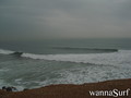
Banana point |
Banana point |

Banana point |
Comments
By chris , 30-06-2005
- This is a good training ground for your next step up to Anchors.. the wave itself is a bit fat and mellow, but by the looks of the posted photo can get some good size. I surfed it around 3-4ft and was only good about half an hour.
Errors, Feedback
You can edit this page to correct errors or add new information. If you have any problems regarding this page, Send us feedback.
Advertise
On the Go!
Wannasurf.com on your mobile

RSS All the RSS feeds of Wannasurf.com
Newsletter All news by email
By Anonymous , 06-12-2007
nice wave - Can get pretty nice. Long walls but always a little bit fat. Holds a lot of size but currents get really strong when its big.