 English
 Español
 Français
 Português
Teiki Mathieu Baillan surfing a self-made Alaya surfboard in Macaroni, Mentawaï, Indonesia. Photo by C. Naslain, 2009.

Enjoy and contribute!
| Find the best surf spots |
|
|

 Del Mar
USA, California, San Diego County
This is an interactive map! Use controls to pan and zoom this map.
|
Datum: WGS84 [ Help ] |
Latitude: 32° 57.837' N |
User rating (4)
- Add to my surfed spots
- Comments (8)
- sessions (1)
- trips (0)
- Photos (14)
- Videos (0)
- Share
- Favourite
-
Your favourites and future surf spot lists
Access
|
Look North from 15th street. Right infront of the lifeguard tower for 17th and streches down all the way to 20th where there is another lifegurad tower DistanceTake a car WalkShort walk (5-15 mn) Easy to find?Easy to find Public access?Public access Special accessDon't know |
Surf Spot Characteristics
Alternative name 17-20th Street
Surf Spot Quality
Wave qualityRegional Classic
ExperienceAll surfers
FrequencyRegular
Wave
TypeBeach-break
DirectionRight and left
BottomSandy
PowerFast, Ordinary
Normal lengthNormal (50 to 150m)
Good day lengthLong (150 to 300 m)
Tide, Swell and Wind
Good swell directionNorthWest, West
Good wind direction
Swell sizeStarts working at Less than 1m / 3ft and holds up to 3m+ / 10ft+
Best tide positionAll tides
Best tide movementRising and falling tides
More details
Week crowdFew surfers
Week-end crowdCrowded
Dangers
- Localism
Additional Information
Atmosphere
General
Author: Anonymous Contributors (2)
 Photos

Del mar |
Del mar |

Del mar |

Del mar |
Comments
By Anonymous , 29-12-2007
Sand depletion - We are so sad that sand depletion has turned this stretch of beach into a backed off closed out. Its gets worse every year and soon it will be just a deep backwash, bouncing off the sea-wall. Sand depletion is ruining our surf zones. Just look at what S.B. is like now. Let the rivers flow and the surf will come back.
By rcstarkey@gmail.com , 07-05-2007
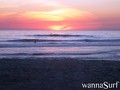
Del Mar Photos - The photo with the rocks MIGHT be of the rocks down by 29th street at the inlet, during a super high tide. I submitted the other two which I took from out in front of our family house at 19th/20th street. -Starkey
Errors, Feedback
You can edit this page to correct errors or add new information. If you have any problems regarding this page, Send us feedback.
Advertise
On the Go!
Wannasurf.com on your mobile

RSS All the RSS feeds of Wannasurf.com
Newsletter All news by email
By Anonymous , 08-12-2010
sand bar. - the sand is all washed out this winter. wont be good for the winter